Australian Catchment Classification Study
Our Project – Nationally Significant
C&R Consulting Pty Ltd were commissioned to undertake a classification study of Australian catchments to group catchments with similar flooding characteristics. This project was a nation-wide catchment regionalisation study with further applications to regional flood studies, particularly in ungauged catchments. The findings are novel, with no published similar study of the same scale.
Expansive Datasets
The study separated catchments into statistically comparable groups (clusters) based on variables that describe flow. Thirty-seven (37) variables were employed from the themes of climate, topography, surface condition and hydrogeology, using our expertise in hydrology, ecology, geology, geomorphology and hydrogeology. The data were collected from various state and national agencies. Numerous difficulties were encountered in the statistical interrogation and interpretation of the available data sets. Australian rainfall, river runoff, and other records are intermittent and usually of short duration. Records accumulated by agricultural stations provide the longest period of recorded data, but these are considered “soft data” and consequently could not be used for this study.
Statistical Analysis for Real World Results
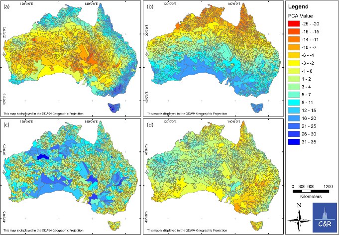
Our methods were designed to cope with the many inconsistencies in the data while still providing reliable and reproducible results. Clustering analysis was used to form 9 clusters representative of the variables used in this study. Data also underwent linear regression, principal component analysis and summation by L-moments prior to clustering.
Our defined clusters have strong links to known physical characteristics of Australia. The similarity with the Köppen Climate Classification for Australia is particularly notable. In addition, C&R found that geomorphological factors can exacerbate or counteract climate effects to produce catchment clusters that are topographically defined, relating to individual Australian landscape features.
What the Future Holds
Despite the general cluster distribution fitting climatological and geomorphological patterns, there are areas of poor cluster fit. The coincidence of these areas with regions of shifting dominant weather systems and locally complex topography implies that further knowledge is needed to best interpret catchment behaviour. It is probable that the anomalies in the cluster membership accuracy arise from interactions between complex topography and yet unknown global climate forces. Investigation of global climate drivers and further application of the findings of this report will have positive impacts on our understanding of the behaviour of gauged and ungauged catchments of Australia.